Average intensity of lightning discharges on the ground. Lightning conductors for trees
Trees are often targets for lightning strikes, which sometimes leads to very serious consequences. We will talk about the danger of being struck by lightning both for the trees themselves and for people living next to them, as well as how you can reduce the risks associated with this phenomenon.
Where does the lightning strike
For a significant part of the Earth's territory, thunderstorms are quite commonplace. At the same time, about one and a half thousand thunderstorms are raging over the Earth. Annually, for example, in Moscow there are more than 20 thunderstorm days. But despite the familiarity of this natural phenomenon, its power cannot but overwhelm. The voltage of an average lightning is about 100,000 volts, and the current strength is 20,000-50,000 amperes. In this case, the temperature of the lightning channel reaches 25,000 - 30,000 ° C. It is not surprising that lightning strikes buildings, trees or people and the spread of its electric charge often leads to catastrophic consequences.
Although a lightning strike of a single ground object, be it a building, a mast or a tree, is a rather rare event, the colossal destructive force makes thunderstorms one of the most dangerous natural phenomena for humans. Thus, according to statistics, every seventh fire in rural areas starts due to a lightning strike; in terms of the number of registered fatalities caused by natural disasters, lightning takes the second place, second only to floods.
The probability of hitting ground objects (including trees) by lightning depends on several factors:
- on the intensity of thunderstorm activity in the region (associated with the peculiarities of the climate);
- from the height of this object (the higher, the more likely a lightning strike);
- from the electrical resistance of the object and the layers of soil located under them (the lower the electrical resistance of the object and the layers of soil located under it, the higher the probability of a lightning discharge into it).
From what has been said, it is clear why trees often become a target for lightning: a tree is often the dominant element of the relief in height, living wood saturated with moisture, associated with deep layers of soil with low electrical resistance, often represents a well-grounded natural lightning rod.
Thunderstorm activity in some localities of the Moscow region
Locality |
Average annual duration of thunderstorms, hours |
Specific density of lightning strikes in 1 km²
|
General characteristics of thunderstorm activity |
|---|---|---|---|
| Volokolamsk |
40–60 |
4 |
high |
| Istra |
40–60 |
4 |
high |
| New Jerusalem |
40–60 |
4 |
high |
| Pavlovsky Posad |
20–40 |
2 |
average |
| Moscow |
20–40 |
2 |
average |
| Kashira |
20–40 |
2 |
average |
What is the danger of being struck by lightning of a tree
The consequences of a lightning strike into a tree are often destructive both for itself and for nearby buildings, and also pose a significant threat to people who are nearby at that moment. At the moment a powerful electric charge passes through the wood, a powerful release of heat and explosive evaporation of moisture inside the trunk occurs. The result is damage of varying severity: from superficial burns or cracks to complete splitting of the trunk or fire of a tree. In some cases, significant mechanical damage occurs inside the trunk (longitudinal cracks or splitting of wood along annual rings), which are almost imperceptible on external examination, but significantly increase the risk of a tree falling in the near future. Often serious, but invisible upon visual inspection, damage can also be inflicted on the roots of the tree.
In the event that damage by lightning does not lead to instant destruction or death of the tree, extensive injuries received by it can cause the development of dangerous diseases, for example, rot, vascular diseases, a weakened plant becomes an easy prey for stem pests. As a result, the tree may become unsafe or dry out.
Lightning strikes into trees (including living ones) often cause fires, which spread to nearby buildings. Sometimes a side discharge from a tree is transmitted to the wall of a building, even if a lightning rod is installed on it. Finally, the electrical potential from the affected tree spreads into the surface layers of the soil, as a result of which it can be carried into the building, damage underground communications, or lead to electric shock to people or pets.
A lightning strike into a tree can cause significant material damage even if there is no emergency. After all, an assessment of the safety of such a tree, special care for it, or even a simple removal of a dead or hopelessly diseased tree can be associated with significant material costs.
Sometimes a side discharge from a tree is transmitted to the wall of a building, even if a lightning rod is installed on it.


Regulatory issues
Thus, lightning protection of especially valuable trees (which are the center of landscape compositions, historical and rare) or trees growing near dwellings can be practically justified. However, the regulatory framework that prescribes or regulates the lightning protection of trees is completely absent in our country. This state of affairs is more likely a consequence of the inertia of the domestic regulatory framework than an adequate assessment of the risks associated with lightning striking trees in an urbanized environment.
The main current domestic standard for lightning protection dates back to 1987. The attitude to lightning protection in the countryside in this document reflects the realities and positions of that time: material value most of the suburban buildings were small, and the interests of the state were focused on the protection of public rather than private property. In addition, the compilers of domestic standards proceeded from the assumption that building codes and regulations are observed during the construction of suburban housing, but this is not always the case. In particular, the minimum distance from a tree trunk to a building wall should be at least 5 m. In the realities of suburban construction, houses are often located close to trees. Moreover, the owners of such trees, as a rule, are reluctant to agree to their removal.
In other countries, there are standards for lightning protection: for example, American - ANSI A 300 Part 4 or British - British Standard 6651 also regulates lightning protection of trees.
The minimum distance from the tree trunk to the building wall must be at least 5 m.
When is protection needed?

When does it make sense to think about lightning protection of a tree? Let us list the factors on the basis of which such a solution can be recommended.
The tree grows in an open area or noticeably higher than neighboring trees, buildings, structures and relief elements... Objects dominant in height are struck by lightning more often.
An area with high thunderstorm activity. With a high frequency of thunderstorms, the likelihood of hitting trees (as well as other objects) increases. The main characteristics of thunderstorm activity are the average annual number of thunderstorm hours, as well as the average specific density of lightning strikes into the ground (average annual number of lightning strikes per 1 km²) of the earth's surface. The latter indicator is used to calculate the expected number of lightning strikes on an object (including a tree) per year. For example, in the case of an area with an average duration of 40–60 thunderstorm hours per year (in particular, some areas of the Moscow Region), a tree 25 m high can be expected to be hit once every 20 years.
Location of the site near water bodies, underground springs, increased soil moisture on the site ... This arrangement further increases the risk of lightning striking the tree.
A tall tree grows three meters or less from a building. This arrangement of the tree does not affect the likelihood of lightning striking it. However, the destruction of trees located near buildings poses significant threats both to the buildings themselves and to the people in them. At the same time, the risk of damage to the building by a lateral discharge increases, the risk of damage to the roof when a tree falls, and when it ignites, the fire can spread to the building.
The branches of a tree hang over the roof of the building, touch its walls, canopies, gutters or decorative elements of the facade... In this case, the risk of damage to the building, fires, discharge of the discharge to the house also increases.
A tree is a species that is frequently or regularly struck by lightning strikes. ... Some trees are more likely to be struck by lightning than others. Oak trees are most often struck by lightning.
The roots of a tree growing next to the building may come into contact with the underground foundation or utilities suitable for the house.... In this case, if a tree is struck by lightning, the likelihood of a discharge "drifting" into the premises or damage to communications (for example, sensors of the irrigation system and power grids) increases.
Specialists in lightning protection of buildings recommend the installation of a free-standing lightning rod, while at a distance of 3 to 10 m there are trees suitable in height and other parameters for installing the lightning rod and down conductor... Installing a separate mast can be quite expensive. For many owners of country houses, such masts are also aesthetically unacceptable. And finally, it can be very difficult to place the mast in the forest area so that during its construction the roots of the trees are not damaged or the guy wires do not interfere with the movement of people.
Susceptibility to damage to unprotected trees of certain species
(from standard ANSI A 300, Part 4)
Operating principle

The principle of operation of the lightning protection system is that a lightning discharge is "intercepted" by a lightning rod, safely conducted by a down conductor and transmitted into deep soil layers by means of grounding.
The components of a tree lightning protection system are: an air terminal (one or more), an overhead down conductor, an underground down conductor and an earthing system consisting of several grounding rods or plates.
When developing our own lightning protection schemes, we faced the need to combine domestic standards for lightning protection of buildings and structures and Western standards regulating lightning protection of trees. The need for such a combination is due to the fact that in the current domestic standards there are no recommendations for installing lightning protection systems on trees, and older regulations include instructions that pose a threat to the health of the tree. At the same time, the American standard ANSI A 300, which contains detailed information on fastening the system to a tree and the principles of its installation and maintenance, imposes lower requirements for the electrical safety of the system in comparison with domestic standards.
Lightning protection components are made of copper or stainless steel. At the same time, in order to avoid corrosion, only one of the selected materials is used in all connections and contacts between conductive elements. However, when using copper, the use of bronze fasteners is allowed. Copper components are more expensive but have higher conductivity, which can reduce component size, make them less visible, and reduce installation costs.
According to statistics, every seventh fire in rural areas starts due to a lightning strike, and in terms of the number of registered deaths caused by natural disasters, lightning takes the second place, second only to floods.
 System components
The lightning rod is a metal tube closed at the end. The down conductor enters into the lightning rod and is attached to it with bolts.
For trees with a spreading crown, additional current collectors are sometimes necessary, since in this case a lightning discharge can strike branches or tops that are far from the lightning rod. If a mechanical support system for branches based on metal cables is installed on a tree, then it must also be grounded when performing lightning protection. For this, an additional down conductor is connected to it with the help of a bolted contact. It should be borne in mind that direct contact of copper with a galvanized cable is unacceptable, as it leads to corrosion.
Down conductors from lightning rods and auxiliary contacts are connected using special clamping contacts or bolted connections. In accordance with the ANSI A 300 standard, for lightning protection of trees, down conductors are used in the form of all-metal steel cables of various weaves. In accordance with domestic standards, the minimum effective cross section of the copper down conductor is 16 mm², the minimum size of the effective cross section of the steel down conductor is 50 mm. When conducting down conductors on a tree, it is necessary to avoid their sharp bends. Bends of down conductors at an angle less than 900 are inadmissible, the radius of curvature of the bend should not be less than 20 cm.
|
|

Down conductors are connected to the trunk with metal clamps buried in the wood of the trunk for a few centimeters. The material of the clamps must not lead to contact corrosion when connected to the down conductor. It is impossible to fix the down conductors by tying them to the tree with a wire, since the radial growth of the trunk will lead to ring injuries and drying out of the tree. Rigid fixation of down conductors on the surface of the barrel (with staples) will lead to their ingrowth into the barrel, reducing the durability and safety of the system and the development of extensive stem rot. The best way to mount the system is to install dynamic clamps. In this case, with an increase in the diameter of the trunk, the holders with the cables are automatically pressed to the end of the rod by the pressure of the wood tissue. It should be noted that deepening the pins of the clamps a few centimeters into the wood and their subsequent partial encapsulation by wood practically does not harm it.
Down conductors go down the shaft to its base and go deep into the trench.
The minimum trench depth for the underground part of the down conductor, prescribed by the ANSI A 300 standard, is 20 cm. Digging of the trench is carried out manually while maintaining the maximum number of roots. In cases where root damage is especially undesirable, special equipment should be used for trenching. For example, an air knife is a compressor tool designed to carry out excavation work in the near-trunk zone of trees. This device, using a strong focused air flow, is able to remove soil particles without damaging even the thinnest roots of the tree.
The type and parameters of the grounding device and the distance to which the down conductor must go to it are determined by the properties of the soil. This is due to the need to reduce the impulse grounding resistance to the required level - the electrical resistance to the spreading of an electric current impulse from the grounding electrode. According to domestic standards, in places regularly visited by people, such resistance should not exceed 10 ohms. This value of resistance to grounding should exclude spark breakdowns of current from the underground conductor and ground electrode to the soil surface and, therefore, prevent damage to people, buildings and communications by electric current. The main soil indicator, which determines the choice of the grounding scheme, is soil resistivity - the resistance between two faces of 1 m³ of earth when current passes through it.
The higher the soil resistivity, the more extensive the grounding system must be in order to ensure the safe drainage of the electrical charge. On soils with low resistivity - up to 300 Ohm (loam, clay, wetland) - as a rule, a grounding system is used from two vertical ground rods connected by a down conductor. A distance of at least 5 m is maintained between the rods. The length of the rods is 2.5–3 m, the upper end of the rod is deepened by 0.5 m.
On soils with high values of resistivity (sandy loam, sands, gravel), multi-beam grounding systems are used. When limiting the possible depth of grounding, grounding plates are used. For the convenience of inspections and testing of the reliability of grounding, small wells are installed above the grounding elements.
Soil resistivity is not a constant value, its value strongly depends on soil moisture. Therefore, in the dry season, the reliability of grounding may decrease. Several techniques are used to prevent this. First, the ground rods are placed in the irrigation area whenever possible. Secondly, top part the rod is deepened 0.5 m below the soil surface (the upper 0.5 m of the soil are most prone to drying out). Thirdly, if necessary, bentonite is added to the soil - a natural moisture-retaining component. Bentonite is small colloidal particles of mineral clay, the pore space of which retains moisture well and stabilizes soil moisture.
Moisture-saturated living wood, associated with deep, low electrical resistance soil layers, is often a well-grounded natural lightning rod.
Common mistakes
In domestic practice, lightning protection of trees is rarely used, and in those cases when it is nevertheless performed, a number of serious mistakes are made during its construction. So, as a rule, metal rods are used as lightning rods, fixed to a tree with wire or metal hoops. This mounting option leads to serious annular trunk injuries, which eventually lead to the complete drying out of the tree. A certain danger is also posed by the ingrowth of the down conductor into the tree trunk, leading to the emergence of extensive open longitudinal wounds on the trunk.
Since the installation of lightning protection on trees is carried out by electricians, they usually use gafs (crampons) to climb a tree - boots with metal spikes that cause serious injury to the tree.
Unfortunately, the peculiarities of the tree crown are also ignored: as a rule, the need to install several lightning rods on multi-peaked trees with wide crowns is not taken into account, and structural defects in tree branching are also not taken into account, which often leads to the breaking and falling of the top with the installed air terminal.
Lightning protection of trees is not a common practice. Indications for its implementation are found in areas with moderate thunderstorm activity rather rarely. Nevertheless, in cases where lightning protection of trees is necessary, its correct implementation is extremely important. When designing and installing such systems, it is important to take into account not only the reliability of the lightning rod itself, but also the safety of the system for the protected tree.
The final reliability of lightning protection will depend both on the correct choice of its materials, contacts and grounding, and on the stability of the tree itself. Only taking into account the peculiarities of the crown structure, radial growth, and the location of the tree root system, it is possible to create a reliable lightning protection system that does not cause dangerous injuries to the tree, which means that it does not create unnecessary risks for people living nearby.
Thunderstorm - what is it? Where do lightning bolts and formidable rumbles of thunder come from? A thunderstorm is a natural phenomenon. Lightning, called can form inside clouds (cumulonimbus), or between and clouds. They are usually accompanied by thunder. Lightning is associated with heavy rain, heavy wind, and often with hail.
Activity
Thunderstorm is one of the most dangerous. People struck by lightning survive only in isolated cases.
At the same time, there are about 1500 thunderstorms on the planet. The intensity of the discharges is estimated at one hundred lightning per second.
The distribution of thunderstorms on Earth is uneven. For example, there are 10 times more of them over the continents than over the ocean. Most (78%) of lightning discharges are concentrated in the equatorial and tropical zones. Thunderstorms are especially often recorded in Central Africa. But the polar regions (Antarctica, Arctic) and lightning poles practically do not see. The intensity of the thunderstorm, it turns out, is associated with the celestial body. In middle latitudes, it peaks in the afternoon (daytime) hours, in the summer. But the minimum was registered before sunrise. Geographical features are also important. The most powerful thunderstorm centers are located in the Cordillera and the Himalayas (mountainous regions). The annual number of "thunderstorm days" in Russia is also different. In Murmansk, for example, there are only four of them, in Arkhangelsk - fifteen, Kaliningrad - eighteen, St. Petersburg - 16, in Moscow - 24, Bryansk - 28, Voronezh - 26, Rostov - 31, Sochi - 50, Samara - 25, Kazan and Ekaterinburg - 28, Ufa - 31, Novosibirsk - 20, Barnaul - 32, Chita - 27, Irkutsk and Yakutsk - 12, Blagoveshchensk - 28, Vladivostok - 13, Khabarovsk - 25, Yuzhno-Sakhalinsk - 7, Petropavlovsk-Kamchatsky - 1.

Thunderstorm development
How does it go? formed only under certain conditions. The presence of ascending streams of moisture is mandatory, while there must be a structure where one fraction of the particles is in the ice state, the other in the liquid state. Convection, which will lead to the development of a thunderstorm, will occur in several cases.
Uneven heating of the surface layers. For example, above water with a significant temperature difference. Over large cities, thunderstorm intensity will be somewhat stronger than in the vicinity.
When cold air displaces warm air. The frontal convention often develops at the same time as overlying and layered rain clouds (clouds).
When the air rises in mountain ranges. Even low elevations can lead to increased cloud formation. This is forced convection.
Any thunderstorm cloud, regardless of its type, necessarily goes through three stages: cumulus, maturity, and decay.

Classification
For some time, thunderstorms were classified only at the place of observation. They were divided, for example, into spelling, local, frontal. Thunderstorms are now classified according to their characteristics, depending on the meteorological environment in which they develop. are formed due to the instability of the atmosphere. This is a basic prerequisite for the creation of thunderclouds. The characteristics of such streams are very important. Depending on their power and size, various types of thunderclouds are formed, respectively. How are they subdivided?
1. Cumulonimbus single cell, (local or intramass). Have hail or thunderstorm activity. Transverse dimensions are from 5 to 20 km, vertical - from 8 to 12 km. Such a cloud “lives” up to an hour. After a thunderstorm, the weather practically does not change.
2. Multi-cell cluster. Here the scale is more impressive - up to 1000 km. A multi-cell cluster encompasses a group of thunderstorm cells located on different stages formation and development and at the same time constituting one whole. How do they work? Mature thunderstorm cells are located in the center, decaying - with transverse their sizes can reach 40 km. Cluster multi-cell thunderstorms "give" gusts of wind (squall, but not strong), downpour, hail. The existence of one mature cell is limited to half an hour, but the cluster itself can “live” for several hours.
3. Lines of squalls. They are also multi-cell thunderstorms. They are also called linear. They can be either solid or with gaps. Wind gusts are longer here (at the leading edge). The multi-cell line appears as a dark wall of clouds when zooming in. The number of streams (both upstream and downstream) is quite large here. That is why such a complex of thunderstorms is classified as multi-cell, although the thunderstorm structure is different. The squall line is capable of producing intense rainfall and large hail, but more often it is "limited" by strong descending currents. Often it passes before a cold front. In the pictures, such a system has the shape of a curved bow.
4. Supercell thunderstorms. Such thunderstorms are rare. They are especially dangerous for property and human life. The cloud of this system is similar to a single-cell cloud, since both differ in the same upstream zone. But they have different sizes. The supercell cloud is huge - close to 50 km in radius, height - up to 15 km. Its boundaries may be in the stratosphere. The shape resembles a single semicircular anvil. The velocity of the ascending streams is much higher (up to 60 m / s). A characteristic feature is the presence of rotation. It is it that creates dangerous, extreme phenomena (large hail (more than 5 cm), destructive tornadoes). The main factor for the formation of such a cloud is the environment. We are talking about a very strong convention with temperatures from +27 and variable winds. Such conditions arise from wind shears in the troposphere. Formed in updrafts, precipitation is carried into the downdraft zone, which ensures long life of the cloud. Precipitation is unevenly distributed. Showers are near the updraft, and hail is closer to the northeast. The back of a thunderstorm may shift. Then the most dangerous zone will be near the main updraft.

There is also the concept of "dry thunderstorm". This phenomenon is quite rare, typical for monsoons. With such a thunderstorm, there is no precipitation (they simply do not reach it, evaporating as a result of exposure to high temperatures).
Travel speed
In an isolated thunderstorm, it is about 20 km / h, sometimes faster. If cold fronts are active, the speed can be 80 km / h. In many thunderstorms, old thunderstorm cells are replaced with new ones. Each of them travels a relatively short path (about two kilometers), but in the aggregate, the distance increases.
Electrification mechanism
Where do lightning bolts come from? around the clouds and inside them are constantly moving. This process is rather complicated. It is easiest to imagine a picture of the work of electric charges in mature clouds. They are dominated by a positive dipole structure. How is it distributed? The positive charge is located at the top, and the negative charge is located below it, inside the cloud. According to the main hypothesis (this area of science can still be considered little known), heavier and larger particles are charged negatively, while small and light ones have a positive charge. The former fall faster than the latter. This becomes the reason for the spatial separation of space charges. This mechanism is confirmed by laboratory experiments. Particles of ice grains or hail can have a strong charge transfer. The magnitude and sign will depend on the water content of the cloud, the temperature of the air (surrounding), the speed of the collision (the main factors). The influence of other mechanisms is not excluded. Discharges occur between the earth and the cloud (or neutral atmosphere, or ionosphere). It is at this moment that we observe the flashes cutting through the sky. Or lightning. This process is accompanied by loud rumbles (thunder).
A thunderstorm is a complex process. Its study can take many decades, and perhaps even centuries.
Storm - an atmospheric phenomenon in which electrical discharges occur inside clouds or between a cloud and the earth's surface - lightning, accompanied by thunder. Typically, a thunderstorm forms in powerful cumulonimbus clouds and is associated with heavy rain, hail and heavy wind.
The thunderstorm is one of the most dangerous natural phenomena for humans: according to the number of registered deaths, only floods lead to greater human losses.

Storm
At the same time, about one and a half thousand thunderstorms act on the Earth, the average intensity of the discharges is estimated at 100 lightning per second. Thunderstorms are unevenly distributed over the planet's surface.

Distribution of lightning discharges over the Earth's surface
Over the ocean, thunderstorms are observed about ten times less than over the continents. In the tropical and equatorial zones (from 30 ° north latitude to 30 ° south latitude), about 78% of all lightning discharges are concentrated. The maximum thunderstorm activity occurs in Central Africa. There are practically no thunderstorms in the polar regions of the Arctic and Antarctic and over the poles. The intensity of thunderstorms follows the sun: the maximum thunderstorms occur in the summer (at mid-latitudes) and in the afternoon. The minimum of registered thunderstorms falls on the time before sunrise. The geographical features of the area also affect thunderstorms: strong thunderstorm centers are located in the mountainous regions of the Himalayas and the Cordilleras.

Stages of development of a thundercloud
The necessary conditions for the emergence of a thundercloud are the presence of conditions for the development of convection or another mechanism that creates upward flows of moisture reserve sufficient for the formation of precipitation, and the presence of a structure in which part of the cloud particles is in a liquid state, and part of it is in an ice state. Convection leading to the development of thunderstorms occurs in the following cases:
With uneven heating of the surface air layer over various underlying surfaces. For example, over water surface and land due to differences in water and soil temperatures. Over large cities, the intensity of convection is much higher than in the vicinity of the city.
When warm air rises or displaces cold air on atmospheric fronts. Atmospheric convection at atmospheric fronts is much more intense and more frequent than with intramass convection. Often, frontal convection develops simultaneously with stratus clouds and overlying precipitation, which masks the resulting cumulonimbus clouds.
When the air rises in mountainous areas. Even small elevations on the ground lead to increased cloud formation (due to forced convection). High mountains create especially difficult conditions for the development of convection and almost always increase its frequency and intensity.
All thunderstorm clouds, regardless of their type, successively go through the stages of a cumulus cloud, a stage of a mature thundercloud and a stage of decay.
Classification of thunderclouds
At one time, thunderstorms were classified according to where they were observed - for example, local, frontal, or orographic. It is now more common to classify thunderstorms according to the characteristics of the thunderstorms themselves, and these characteristics largely depend on the meteorological environment in which the thunderstorm develops.
The main prerequisite for the formation of thunderstorm clouds is the state of instability of the atmosphere, which forms ascending currents. Thunderstorm clouds of various types are formed depending on the size and power of such streams.
Single cell cloud
Single-cell cumulonimbus clouds develop on days with light winds in a low-gradient baric field. They are also called intramass or local thunderstorms. They consist of a convective cell with an upward flow in its central part. They can reach thunderstorm and hail intensity and quickly collapse with precipitation. The dimensions of such a cloud are: transverse - 5-20 km, vertical - 8-12 km, lifespan - about 30 minutes, sometimes up to 1 hour. There are no major changes in the weather after a thunderstorm.

Single cell cloud life cycle
A thunderstorm begins with the appearance of a cumulus cloud of good weather (Cumulus humilis). Under favorable conditions, the formed cumulus clouds grow rapidly both in the vertical and horizontal directions, while the ascending currents are located almost throughout the entire volume of the cloud and increase from 5 m / s to 15-20 m / s. The downdrafts are very weak. Ambient air actively penetrates into the cloud due to mixing at the border and top of the cloud. The cloud enters the Cumulus mediocris stage. The smallest water droplets formed as a result of condensation in such a cloud merge into larger ones, which are carried away by powerful ascending currents upward. The cloud is still homogeneous, it consists of water droplets held by an updraft - no precipitation falls. In the upper part of the cloud, when water particles enter the zone of negative temperatures, the drops gradually begin to turn into ice crystals. The cloud enters the Cumulus congestus stage. The mixed composition of the cloud leads to the enlargement of cloud elements and the creation of conditions for precipitation. Such a cloud is called Cumulonimbus (Cumulonimbus) or Bald Cumulonimbus (Cumulonimbus calvus). Vertical streams in it reach 25 m / s, and the level of the summit reaches a height of 7-8 km.
Evaporating precipitation particles cool the surrounding air, which further intensifies the downdrafts. At the stage of maturity, both ascending and descending air currents are simultaneously present in the cloud.
At the stage of decay, downdrafts prevail in the cloud, which gradually cover the entire cloud.
Multi-cell cluster thunderstorms

Multi-cell lightning structure diagram
This is the most common type of thunderstorm associated with mesoscale (ranging from 10 to 1000 km) disturbances. A multi-cell cluster consists of a group of thunderstorm cells moving as a whole, although each cell in the cluster is at a different stage in the development of a thundercloud. Mature thunderstorm cells are usually located in the central part of the cluster, while decaying cells are located on the leeward side of the cluster. They have a transverse size of 20-40 km, their tops often rise to the tropopause and penetrate into the stratosphere. Multi-cell cluster thunderstorms can produce hail, heavy showers, and relatively weak squall winds. Each individual cell in a multicellular cluster is mature for about 20 minutes; the multi-cell cluster itself can exist for several hours. This type of thunderstorm is usually more intense than a single cell thunderstorm, but much weaker than a supercell thunderstorm.
Multi-cell linear thunderstorms (squall lines)
Multi-cell linear thunderstorms are a line of thunderstorms with a long, well-developed front of gusts of wind on the front line. The squall line can be solid or contain gaps. The approaching multi-cell line looks like a dark wall of clouds, usually covering the horizon from the western side (in the northern hemisphere). A large number of closely spaced ascending / downgrading air flows makes it possible to qualify this complex of thunderstorms as a multi-cell thunderstorm, although its thunderstorm structure differs sharply from a multi-cell cluster thunderstorm. Squall lines can produce heavy hail and heavy rainfall, but are better known as systems that create strong downdrafts. The squall line is similar in properties to the cold front, but is a local result of thunderstorm activity. Often, a squall line occurs in front of a cold front. On radar images, this system resembles a bow echo. This phenomenon is typical for North America; it is observed less often in Europe and the European territory of Russia.
Supercell thunderstorms

Vertical and horizontal structure of the supercellular cloud
A supercell is the most highly organized thundercloud. Supercell clouds are relatively rare, but pose the greatest threat to human health and life and property. A supercell cloud is similar to a single cell cloud in that both have one upflow zone. The difference lies in the fact that the cell size is enormous: the diameter is about 50 km, the height is 10-15 km (often the upper boundary penetrates into the stratosphere) with a single semicircular anvil. The ascending flow velocity in a supercell cloud is much higher than in other types of thunderstorm clouds: up to 40-60 m / s. The main feature that distinguishes the supercellular cloud from other types of clouds is the presence of rotation. A rotating updraft in a supercell cloud (in radar terminology called mesocyclone), creates extreme weather events, such as a giant hail(more than 5 cm in diameter), gale winds up to 40 m / s and strong destructive tornadoes. Ambient conditions are a major factor in supercellular cloud formation. A very strong convective instability of the air is required. The air temperature near the ground (before the thunderstorm) should be + 27 ... + 30 and above, but the main prerequisite is an alternating wind, which causes rotation. Such conditions are achieved with wind shear in the middle troposphere. The precipitation formed in the updraft is carried over the upper level of the cloud by a strong stream into the downdraft zone. Thus, the zones of the ascending and descending streams are separated in space, which ensures the life of the cloud for a long period of time. Light rain is usually observed at the leading edge of the supercellular cloud. Heavy rain falls near the zone of the updraft, and the heaviest rainfall and large hail falls to the northeast of the zone of the main updraft. The most dangerous conditions are observed near the zone of the main updraft (usually shifted towards the rear of the thunderstorm).
Supercell (eng. super and cell- cell) - a type of thunderstorm characterized by the presence of a mesocyclone - a deep, strongly rotating updraft. For this reason, such storms are sometimes referred to as spinning thunderstorms. Of the four types of thunderstorms according to Western classifications (supercell, skulline, multisell and singlesell), supercells are the least common and can be the most dangerous. Supercells are often isolated from other thunderstorms and can have a front span of up to 32 kilometers.

Supercell at sunset
Supercells are often subdivided into three types: classic; low precipitation (LP); and with high level precipitation (HP). LP supercells tend to form in drier climates, such as the high valleys of the United States, while HP supercells are more common in more humid climates. Supercells can be observed anywhere in the world if the weather conditions are suitable for their formation, but they are most common in the Great Plains of the United States - in the area known as the Tornado Valley. They can also be observed in the plains in Argentina, Uruguay and southern Brazil.
Physical characteristics of thunderclouds

Aircraft and radar studies show that a single thunderstorm cell usually reaches an altitude of the order of 8-10 km and lives for about 30 minutes. An isolated thunderstorm usually consists of several cells in different stages of development and lasts about an hour. Large thunderstorms can reach tens of kilometers in diameter, their summit can reach heights of over 18 km, and they can last for many hours.
Upstream and downstream flows
The updrafts and downdrafts in isolated thunderstorms are usually 0.5 to 2.5 km in diameter and 3 to 8 km in height. Sometimes the diameter of the updraft can reach 4 km. Near the surface of the earth, streams usually increase in diameter, and their velocity decreases in comparison with higher streams. The characteristic velocity of the upward flow is in the range from 5 to 10 m / s and reaches 20 m / s in the upper part of large thunderstorms. Research aircraft flying through a thundercloud at an altitude of 10,000 m register ascending velocities in excess of 30 m / s. The strongest updrafts are observed in organized thunderstorms.
Squalls

Before the August 2010 flurry in Gatchina
In some thunderstorms, intense downdrafts occur, creating destructive winds on the surface of the earth. Depending on the size, these downstreams are called squalls or microscales. A squall with a diameter of more than 4 km can create winds of up to 60 m / s. Micro-squalls are smaller, but create wind speeds of up to 75 m / s. If a thunderstorm generating a squall is formed from a sufficiently warm and humid air, then the micro-squall will be accompanied by an intense rainstorm. However, if a thunderstorm is formed from dry air, the precipitation during the fallout may evaporate (evaporating streaks of precipitation or virga), and the micro-squall will be dry. Downdraft air currents are a serious hazard to aircraft, especially during takeoff or landing, as they create wind near the ground with strong sudden changes in speed and direction.
Vertical development
In general, an active convective cloud will rise until it loses its buoyancy. Loss of buoyancy is related to the load caused by precipitation in the cloudy environment, or mixing with the surrounding dry cold air, or a combination of the two. Cloud growth can also be stopped by a blocking inversion layer, that is, a layer where the air temperature rises with height. Usually thunderstorm clouds reach heights of the order of 10 km, but sometimes they reach heights of more than 20 km. When the moisture content and instability of the atmosphere are high, then with a favorable wind, the cloud can grow to the tropopause, the layer that separates the troposphere from the stratosphere. The tropopause is characterized by a temperature that remains approximately constant with increasing altitude and is known as a region of high stability. As soon as the updraft begins to approach the stratosphere, then pretty soon the air at the top of the cloud becomes colder and heavier than the surrounding air, and the growth of the top stops. The height of the tropopause depends on the latitude of the area and on the season of the year. It ranges from 8 km in the polar regions to 18 km and more near the equator.
When the cumulus convective cloud reaches the blocking layer of the inversion of the tropopause, it begins to spread out to the sides and forms the "anvil" characteristic of thunderclouds. The wind blowing at the height of the anvil usually carries the cloudy material in the direction of the wind.
Turbulence
An airplane flying through a thunderstorm cloud (it is prohibited to fly into cumulonimbus clouds) usually gets into a bump, throwing the airplane up, down and to the sides under the influence of turbulent cloud flows. Atmospheric turbulence creates a feeling of discomfort for the aircraft crew and passengers and causes unwanted stresses on the aircraft. Turbulence is measured in different units, but more often it is defined in units of g - the acceleration of gravity (1g = 9.8 m / s 2). A squall of one g creates turbulence dangerous for aircraft. In the upper part of intense thunderstorms, vertical accelerations of up to three g were recorded.
Thunderstorm movement
The speed and movement of a thundercloud depends on the direction of the earth, first of all, by the interaction of the ascending and descending streams of the cloud with the carrying air currents in the middle layers of the atmosphere, in which the thunderstorm develops. The travel speed of an isolated thunderstorm is usually on the order of 20 km / h, but some thunderstorms move much faster. In extreme situations, a thundercloud can move at speeds of 65-80 km / h - during the passage of active cold fronts. In most thunderstorms, as the old thunderstorm cells dissipate, new thunderstorm cells appear in succession. In a weak wind, an individual cell can travel a very short distance during its life, less than two kilometers; however, in larger thunderstorms, new cells are triggered by the downdraft flowing out of the mature cell, giving the impression of a rapid movement that does not always coincide with the direction of the wind. In large multi-cell thunderstorms, there is a pattern when a new cell is formed to the right of the direction of the carrier air flow in the Northern Hemisphere and to the left of the direction of the carrier flow in the Southern Hemisphere.
Energy
The energy that drives a thunderstorm is contained in latent heat released when water vapor condenses and forms cloudy droplets. For every gram of water condensing in the atmosphere, approximately 600 calories of heat are released. When water droplets freeze at the top of the cloud, an additional 80 calories per gram are released. The released latent thermal energy is partially converted into kinetic energy of the updraft. A rough estimate of the total energy of a thunderstorm can be made based on the total amount of rainfall from the cloud. Typical energy is about 100 million kilowatt-hours, which is roughly equivalent to a nuclear charge of 20 kilotons (although this energy is released in a much larger volume of space and for a much longer time). Large multi-cell thunderstorms can be 10 or 100 times more energetic.
Downdrafts and squall fronts

A squall front of a powerful thunderstorm
Downdrafts in thunderstorms occur at altitudes where the air temperature is lower than the temperature in the surrounding space, and this stream becomes even colder when ice particles of precipitation begin to melt in it and cloud droplets evaporate. The air in the downdraft is not only denser than the surrounding air, but it also carries a horizontal angular momentum, which differs from the surrounding air. If a downdraft occurs, for example, at an altitude of 10 km, then it will reach the earth's surface with a horizontal speed that is noticeably greater than the wind speed near the earth. At the ground, this air is carried forward before a thunderstorm at a speed greater than the speed of the entire cloud. That is why an observer on the ground will feel the approach of a thunderstorm along the flow of cold air even before the thundercloud is over his head. The downdraft spreading along the ground forms a zone with a depth of 500 meters to 2 km with a distinct difference between the cold air of the flow and the warm humid air from which a thunderstorm is formed. The passage of such a squall front is easily determined by the increase in wind and a sudden drop in temperature. The temperature can drop 5 ° C or more in five minutes. The squall forms a characteristic squall gate with a horizontal axis, a sharp drop in temperature and a change in wind direction.
In extreme cases, the downdraft squall front can reach speeds in excess of 50 m / s and wreak havoc on homes and crops. More often, violent squalls occur when an organized line of thunderstorms develops in high wind conditions at medium altitudes. At the same time, people may think that this destruction is caused by a tornado. If there are no witnesses who have seen the characteristic funnel-shaped cloud of a tornado, then the cause of the destruction can be determined by the nature of the destruction caused by the wind. In tornadoes, destruction has a circular pattern, and a thunderstorm squall caused by a downdraft carries destruction mainly in one direction. Cold air is followed by rain. In some cases, raindrops evaporate completely during a fall, resulting in a dry thunderstorm. In the opposite situation, which is typical for severe multi-cell and super-cell thunderstorms, there is heavy rain and hail, causing flash floods.
Tornadoes
A tornado is a strong, small-scale vortex beneath thunderclouds with an approximately vertical but often curved axis. A pressure drop of 100-200 hPa is observed from the periphery to the center of the tornado. The wind speed in tornadoes can exceed 100 m / s, theoretically it can reach the speed of sound. In Russia, tornadoes occur relatively rarely, but they cause colossal damage. The highest frequency of tornadoes occurs in the south of the European part of Russia.
Showers
In small thunderstorms, the five-minute peak of intense precipitation can exceed 120 mm / hour, but the rest of the rain is much less intense. An average thunderstorm gives about 2,000 cubic meters of precipitation, but a large thunderstorm can give ten times that. Large organized thunderstorms associated with mesoscale convective systems can create 10 to 1000 million cubic meters of precipitation.
Electrical structure of a thundercloud

Charge structure in thunderclouds in different regions
The distribution and movement of electric charges in and around a thunderstorm cloud is a complex, continuously changing process. Nevertheless, it is possible to present a generalized picture of the distribution of electric charges at the stage of cloud maturity. A positive dipole structure dominates, in which the positive charge is at the top of the cloud, and the negative charge is below it inside the cloud. A lower positive charge is observed at the base of the cloud and below it. Atmospheric ions, moving under the action of an electric field, form shielding layers at the cloud boundaries, masking the electrical structure of the cloud from an external observer. Measurements show that in different geographic conditions, the main negative charge of a thunderstorm cloud is located at altitudes with an ambient temperature of −5 to −17 ° C. The higher the velocity of the ascending flow in the cloud, the higher the center of the negative charge is. The density of the space charge is in the range of 1-10 C / km³. There is a noticeable proportion of thunderstorms with an inverted charge structure: - a negative charge in the upper part of the cloud and a positive charge in the inner part of the cloud, as well as with a complex structure with four or more zones of space charges of different polarity.
Electrification mechanism
Many mechanisms have been proposed to explain the formation of the electrical structure of a thundercloud, and this area of science is still an area of active research. The main hypothesis is based on the fact that if larger and heavier cloud particles are charged predominantly negatively, and lighter small particles carry a positive charge, then the spatial separation of space charges arises due to the fact that large particles fall at a faster rate than small cloud components. This mechanism, in general, is consistent with laboratory experiments, which show strong charge transfer when particles of ice grains (grains are porous particles from frozen water droplets) or hail particles interact with ice crystals in the presence of supercooled water droplets. The sign and magnitude of the charge transferred during contacts depend on the temperature of the ambient air and the water content of the cloud, but also on the size of the ice crystals, the collision speed, and other factors. The action of other mechanisms of electrification is also possible. When the volume of electric charge accumulated in the cloud becomes large enough, a lightning discharge occurs between the areas charged with the opposite sign. The discharge can also occur between the cloud and the earth, the cloud and the neutral atmosphere, the cloud and the ionosphere. In a typical thunderstorm, two-thirds to 100 percent of the discharges are intra-cloud discharges, inter-cloud discharges, or cloud-to-air discharges. The rest is cloud-to-ground discharges. In recent years, it has become clear that lightning can be artificially initiated in a cloud, which, under normal conditions, does not turn into a thunderstorm stage. In clouds that have electrification zones and create electric fields, lightning can be initiated by mountains, high-rise buildings, aircraft or rockets that find themselves in a zone of strong electric fields.


Zarnitsa - instant flashes of light on the horizon in a distant thunderstorm.

During lightning, peals of thunder are not heard due to the range, but you can see flashes of lightning, the light of which is reflected from cumulonimbus clouds (mainly their tops). The phenomenon is observed in the dark, mainly after July 5th, at the time of harvesting grain crops, therefore, the lightning was popularly timed to the end of summer, the beginning of the harvest and is sometimes called bakeries.
Snow storm

The scheme of the formation of a snow thunderstorm
Snow thunderstorm (also snow thunderstorm) - a thunderstorm, a very rare meteorological phenomenon, occurs in the world 5-6 times a year. Instead of heavy rain, there is heavy snow, freezing rain or ice pellets. The term is used mainly in popular science and foreign literature (eng. thundersnow). In professional Russian meteorology, this term is absent: in such cases, a thunderstorm and heavy snow are noted simultaneously.
Cases of winter thunderstorms are noted in ancient Russian chronicles: thunderstorms in the winter in 1383 (there was “the thunder is very terrible and the whirlwind was strong for the velmi”), in 1396 (in Moscow on December 25 “... there was a thunder, and a cloud from the midday country”), in 1447 year (in Novgorod on November 13 "... at midnight a terrible thunder and lightning was great too"), in 1491 (in Pskov on January 2 thunder was heard).
How does a thundercloud form?
What is known about a thundercloud?
On average, it is believed that a thundercloud is 20 km in diameter and has a lifespan of 30 minutes. At every moment on the globe, there are, according to various estimates, from 1800 to 2000 thunderclouds. This equates to 100,000 thunderstorms annually on the planet. Approximately 10% of them become extremely dangerous.
In general, the atmosphere should be unstable - air masses at the surface of the earth should be lighter than air located in higher layers. This is possible when the underlying surface warms up and the air mass from it, as well as the presence of high air humidity, which is the most common. Perhaps, due to some dynamic reasons, the influx of colder air masses into the overlying layers. As a result, in the atmosphere, volumes of warmer and more humid air, gaining buoyancy, rush upward, and colder particles from the upper layers descend. Thus, the heat, which the earth's surface receives from the sun, is transported to the overlying layers of the atmosphere. This convection is called free. In the zones of atmospheric fronts, in the mountains, it is also intensified by the forced mechanism of the rise of air masses.
The water vapor in the rising air cools and condenses to form clouds and heat. Clouds grow upward, reaching a height where temperatures are below zero. Some of the cloud particles freeze, and some remain liquid. Both those and others have an electric charge. Ice particles are usually positively charged, while liquid particles are negatively charged. The particles continue to grow and begin to settle in the gravitational field - precipitation is formed. There is an accumulation of space charges. A positive charge is formed in the upper part of the cloud, and a negative one at the bottom (in fact, a more complex structure is noted, 4 space charges can be noted, sometimes it can be inversion, etc.). When the strength of the electric field reaches a critical value, a discharge occurs - we see lightning and, after a while, we hear a sound wave or thunder emanating from it.
Typically, a thundercloud passes through three stages during its life cycle: formation, maximum development, and dissipation.
In the first stage, cumulus clouds grow upward due to the ascending air movements. Cumulus clouds appear as beautiful white towers. There is no precipitation at this stage, but lightning is not ruled out. This can take about 10 minutes.
At the stage of maximum development, ascending movements continue in the cloud, but at the same time, precipitation is already beginning to fall out of the cloud, and strong downward movements appear. And when this descending cooled stream with precipitation reaches the ground, a gust front, or a line of squalls, is formed. The stage of maximum cloud development is the time of the greatest probability of heavy rainfall, hail, frequent lightning, squalls and tornadoes. The cloud is usually dark in color. This stage lasts from 10 to 20 minutes, but may be longer.
Eventually, precipitation and downdrafts begin to erode the cloud. At the surface of the earth, a line of squalls extends far from the cloud, cutting it off from the source of warm and humid air that supplied it. The rainfall is decreasing, but lightning is still dangerous.
Due to its perfect unpredictability and enormous power lightning(lightning discharges), they pose a potential hazard to numerous power facilities. Modern science has accumulated a large amount of theoretical information and practical data on lightning protection and thunderstorm activity, and this allows us to solve serious problems associated with lightning protection of industrial and civil energy infrastructure. This article discusses the physical nature of thunderstorms and the behavior of lightning, the knowledge of which will be useful for arranging effective lightning protection and creating an integrated grounding system for electrical substations.
Nature of lightning and storm clouds
In the warm season in mid-latitudes during the movement of the cyclone, with sufficient humidity and strong upward air currents, lightning discharges (lightning) often occur. The reason for this natural phenomenon lies in the huge concentration of atmospheric electricity (charged particles) in thunderclouds, in which, in the presence of ascending currents, the separation of negative and positive charges occurs with the accumulation of charged particles in different parts of the cloud. Today, there are several theories concerning atmospheric electricity and the electrification of thunderstorm clouds, as the most important factors that have a direct impact on the design and creation of integrated lightning protection and grounding of power facilities.
According to modern concepts, the formation of charged particles in clouds is associated with the presence of an electric field at the Earth, which has a negative charge. Near the surface of the planet, the electric field strength is 100 V / m. This value is almost the same everywhere, does not depend on the time and place of measurements. The electric field of the Earth is due to the presence of free charged particles in the atmospheric air, which are in constant motion.
For example, in 1 cm3 of air there are more than 600 positively charged particles and the same number of negatively charged particles. With distance from the earth's surface in the air, the density of particles with a charge increases sharply. Close to the ground, the electrical conductivity of air is negligible, but already at altitudes of more than 80 km, the electrical conductivity increases 3,000,000,000 (!) Times and becomes equal to the conductivity of fresh water. If we draw analogies, then in the first approximation our planet can be compared with a huge condenser in the shape of a ball.
In this case, the Earth's surface and the air layer concentrated at an altitude of eighty kilometers above the earth's surface are taken as the plates. A part of the atmosphere 80 km thick, which has a low electrical conductivity, acts as an insulator. A voltage of up to 200 kV occurs between the plates of the virtual capacitor, and the current strength can be up to 1,400 A. Such a capacitor has an incredible power - about 300,000 kW (!). In the electric field of the planet, at an altitude between 1 and 8 kilometers from the level of the earth's surface, charged particles condense and thunderstorms arise, which worsen the electromagnetic situation and are a source of impulse noise in energy systems.
Thunderstorms are classified into frontal and thermal thunderstorms. In Fig. 1 shows a diagram of the appearance of a thermal thunderstorm. As a result of intense exposure to sunlight, the earth's surface heats up. Part of the thermal energy passes into the atmosphere and heats its lower layers. Warm air masses expand and rise higher. Already at an altitude of two kilometers, they reach a region of low temperatures, where moisture condensation occurs and thunderstorm clouds appear. These clouds are made up of microscopic water droplets that carry a charge. As a rule, thunderclouds form on hot summer days in the afternoon and are relatively small in size.

Frontal thunderstorms are formed when two air currents with different temperatures collide with their frontal parts. Air flow with low temperature goes down, closer to the ground, and warm air masses rush upward (Fig. 2). Thunderclouds form at altitudes with low temperatures, where humid air condenses. Frontal thunderstorms can be quite long and cover a large area.
At the same time, the background electromagnetic environment is noticeably distorted, inducing impulse noise in electrical networks. Such fronts move at a speed of 5 to 150 km / h and more. Unlike thermal thunderstorms, frontal thunderstorms are active almost around the clock and pose a serious danger to industrial facilities that are not equipped with a lightning protection system and effective grounding. During condensation in the electric field of cold air, polarized water droplets are formed (Fig. 3): in the lower part of the droplets there is a positive charge, in the upper part - a negative one.
Due to the ascending air flows, the separation of water drops occurs: the smaller ones rise up, and the larger ones fall below. When the drop moves upwards, the negatively charged part of the drop attracts positive charges and repels negative ones. As a result, the drop becomes positively charged. gradually collects a positive charge. Drops that fall down attract negative charges and, in the process of falling, turn out to be negatively charged.

The division of charged particles in a thunderstorm cloud occurs in a similar way: positively charged particles accumulate in the upper layer, and negatively charged ones in the lower layer. A thundercloud is practically not a conductor, and for this reason, the charges persist for some time. If a stronger electric field of the cloud acts on the electric field of "clear weather", then it will change its direction at the location (Fig. 4).

The distribution of charged particles in the cloud mass is extremely uneven:
at some points the density has a maximum value, and at others it is small. In the place where a large number of charges accumulate and a strong electric field is formed with a critical strength of the order of 25-30 kV / cm, suitable conditions arise for the formation of lightning. A lightning thunderstorm is like a spark seen between electrodes that conduct electricity well.
Ionization of atmospheric air
Atmospheric air consists of a mixture of gases: nitrogen, oxygen, inert gases and water vapor. The atoms of these gases combine into strong and stable bonds, forming molecules. Each atom is a positively charged nucleus of protons. Electrons with a negative charge ("electron cloud") revolve around the nucleus.
In quantitative terms, the charge of the nucleus and the total charge of the electrons are equal to each other. During ionization, electrons leave the atom (molecule). During atmospheric ionization, 2 charged particles are formed: a positive ion (a nucleus with electrons) and negative ion(free electron). Like many physical phenomena, ionization requires a certain amount of energy called the ionization energy of air.
When sufficient voltage arises in the air layer formed by 2 conducting electrodes, then all free charged particles will begin to move in an orderly manner under the influence of the electric field strength. The mass of an electron is many times (10,000 ... 100,000 times) less than the mass of the nucleus. As a result, when a free electron moves in the electric field of the air layer, the speed of this charged particle is much greater than the speed of the nucleus. Possessing a significant momentum, an electron easily tears off new electrons from molecules, thereby making ionization more intense. This phenomenon is called impact ionization (Fig. 5).

However, not every collision occurs when an electron is detached from a molecule. In some cases, electrons move to unstable orbits far from the nucleus. Such electrons receive part of the energy from the colliding electron, which leads to the excitation of the molecule (Fig. 6.).

The period of "life" of an excited molecule is only 10-10 seconds, after which the electron returns to its previous, more energetically stable orbit.

When the electron returns to a stable orbit, the excited molecule emits a photon. The photon, in turn, under certain conditions, can ionize other molecules. This process was called photoionization (Fig. 7). There are also other sources of photoionization: high energy cosmic rays, ultraviolet light waves, radioactive radiation, etc. (Fig. 8).

As a rule, ionization of air molecules occurs at high temperatures. As the temperature rises, air molecules and free electrons participating in thermal (chaotic) motion acquire higher energy and more often collide with each other. The result of such collisions is air ionization, called thermal ionization. However, reverse processes can also occur when charged particles neutralize their own charges (recombination). In the process of recombination, intense emission of photons is noted.
Streamer and corona formation
When the electric field strength in the air gap between the charged plates increases to critical values, impact ionization may develop, which is a common cause of pulsed high-frequency interference. Its essence is as follows: after ionization of one molecule by an electron, two free electrons and one positive ion appear. Subsequent collisions lead to the appearance of 4 free electrons and 3 ions with a positive charge.
Thus, ionization takes on an avalanche-like character, which is accompanied by the formation of a huge amount of free electrons and positive ions (Figs. 9 and 10). Positive ions accumulate near the negative electrode, and negatively charged electrons move to the positive electrode.


In the course of ionization, free electrons acquire greater mobility compared to ions; therefore, the latter can be conventionally considered immobile particles. When electrons move to the positive electrode, the remaining positive charges have a strong effect on the state of the electric field, thereby leading to an increase in its strength. A large number of photons accelerates the ionization of the air near the anode and contributes to the appearance of secondary electrons (Fig. 11), which are the sources of repeated avalanches (Fig. 12).


The resulting secondary avalanches move to the anode, where the positive charge is concentrated. Free electrons break through the positive space charge, leading to the formation of a rather narrow channel (streamer) in which the plasma is located. Due to its excellent conductivity, the streamer "lengthens" the anode, while the process of formation of avalanches of free electrons is accelerated and a further increase in the electric field strength occurs (Figs. 13 and 14), moving towards the head of the streamer. Additional electrons are mixed with positive ions, again leading to the formation of plasma, due to which the streamer channel is lengthened.

Rice. 13. An increase in the electric field strength is accompanied by an increase in photoionization and generates new avalanches of charged particles

After filling the free gap with the streamer, the spark stage of the discharge begins (Fig. 15), characterized by super-powerful thermal ionization of the space and ultra-conductivity of the plasma channel.

The described process of streamer formation is valid for small gaps characterized by a uniform electric field. However, according to their form, all electric fields are divided into homogeneous, weakly inhomogeneous and highly inhomogeneous:
- Within a uniform electric field, the strength along the lines of force is characterized by a constant value. For example, the electric field in the middle of a flat type capacitor.
- In a weakly inhomogeneous field, the strength values measured along the lines of force differ by no more than 2 ... 3 times, such a field is considered to be weakly inhomogeneous. For example, an electric field between 2 spherical arresters or an electric field arising between the sheath of a shielded cable and its core.
- An electric field is called highly inhomogeneous if it is characterized by significant surges in strength, which leads to a serious deterioration of the electromagnetic environment. In industrial electrical installations, as a rule, electric fields have a highly inhomogeneous shape, which requires checking the devices for electromagnetic compatibility.
In a highly inhomogeneous field, ionization processes gather near the positive or negative electrode. Therefore, the discharge cannot reach the spark stage, and in this case the charge is formed in the form of a corona ("corona discharge"). With a further increase in the electric field strength in the air gap, streamers are formed and a spark discharge occurs. So, if the length of the gap is one meter, then the spark discharge occurs at a field strength of about 10 kV / cm.
Leading form of lightning discharge
With an air gap of several meters, the streamers being formed do not have sufficient conductivity for the development of a full-fledged discharge. In the course of the streamer's movement, a thunderstorm discharge is formed, which takes a leader form. The part of the channel, called the leader, is filled with thermally ionized particles. A significant number of charged particles are concentrated in the leader's channel, the density of which is much higher than the average for the streamer. This property provides good conditions to form a streamer and transform him into a leader.

Rice. 16. The process of streamer movement and the emergence of a negative leader (AB - initial avalanche; CD - formed streamer).
In Fig. 16 shows the classic scheme of the emergence of a negative leader. The flow of free electrons moves from the cathode to the anode. The shaded cones show the formed avalanches of electrons, and the trajectories of the emitted photons are shown in the form of wavy lines. In each avalanche, during collisions of electrons, the air is ionized, while the resulting photons subsequently ionize other air molecules. Ionization becomes massive and numerous avalanches merge into one channel. The speed of the photons is 3 * 108 m / s, and the speed of freely moving electrons in the frontal part of the avalanche is 1.5 * 105 m / s.
The streamer develops faster than an avalanche of electrons. In Fig. 16 shows that during the time the first avalanche passes the distance AB, on the segment CD, a streamer channel with ultraconductivity is formed along the entire length. A standard streamer moves at an average speed of 106-107 m / s. If free electrons have a sufficiently high concentration, intense thermal ionization arises in the streamer channel, which leads to the appearance of a leader — a linear structure with a plasma component.
In the process of the leader's movement, new streamers are formed in its end part, which later also pass into the leader. In Fig. 17 shows the development of a negative leader in an air gap with an inhomogeneous electric field: the leader moves along the streamer channel (Fig. 17a); after the transformation of the streamer channel into a leader is completed, new avalanches appear.

Rice. 17. Scheme of education and development of a negative leader over an extended period.
Electronic avalanches move along the entire air gap (Fig. 17b) and a new streamer is formed (Fig. 17c). Typically, streamers move along random paths. With such a formation of a lightning discharge in extended air gaps, even at low electric field strengths (from 1,000 to 2,000 V / cm), the leader quickly travels significant distances.
When the leader reaches the opposite electrode, the leader stage of the lightning discharge ends and the stage of the reverse (main) discharge begins. In this case, an electromagnetic wave propagates from the earth's surface along the leader's channel, due to which the leader's potential decreases to zero. Thus, a superconducting channel is formed between the electrodes, through which the lightning discharge passes.
Stages of development of a lightning discharge
The conditions for the occurrence of lightning are formed in that part of the thundercloud where the accumulation of charged particles and the electric field strength have reached threshold values. At this point, impact ionization develops and electron avalanches are formed; then, under the influence of photo- and thermal ionization, streamers appear, which turn into leaders.

a - visual display; b - current characteristic.
The length of lightning is from hundreds of meters and can reach several kilometers (the average length of a lightning discharge is 5 km). Due to the leader type of development, lightning is able to travel considerable distances within a fraction of a second. The human eye sees lightning as a continuous line of one or more bright stripes of white, light pink, or bright blue. In fact, a lightning discharge is a few impulses, which includes two stages: a leader and a reverse discharge stage.
In Fig. 18 shows a sweep of lightning impulses in time, which shows the discharge of the leader stage of the first impulse developing in the form of steps. On average, the line of a step is fifty meters, and the delay between adjacent steps reaches 30-90 μs. The average propagation speed of the leader is 105 ... 106 m / s.
The stepwise form of leader development is explained by the fact that it takes some time for the formation of a leading streamer (a pause between steps). Subsequent impulses move along the ionized channel and have a pronounced arrow-shaped leader stage. After the leader reaches the 1st pulse of the earth's surface, an ionized channel appears, along which the charge moves. At this moment, the 2nd stage of the lightning discharge (reverse discharge) begins.
The main discharge is seen in the form of a continuous, brightly glowing line piercing the space between thunderclouds and the ground (line lightning). After the main discharge reaches the cloud, the glow of the plasma channel decreases. This phase is called afterglow. In one lightning discharge, up to twenty repeated impulses are noted, and the duration of the discharge itself reaches 1 or more seconds.
In four out of ten cases, there is a multiple lightning discharge, which is the cause of impulse noise in power networks. On average, there are 3 ... 4 impulses. The nature of the repeated impulses is associated with the gradual inflow of the remaining charges in the thundercloud to the plasma channel.
Selective action of lightning discharge
When the leader channel is just beginning to develop, the strength of the electric field in its head is determined by the volume of the leader's charge and the accumulations of bulk charged particles under the thundercloud. The priority direction of the discharge depends on the maximum electric field strengths. At a considerable height, this direction is determined only by the leader's channel (Fig. 19).

When the leader channel of a lightning discharge moves towards the earth's surface, its electric field is distorted by the field of the earth and massive ground-based power objects. The maximum intensity values and the direction of propagation of the lightning leader are determined by both its own charges and charges concentrated on the ground, as well as on artificial structures (Fig. 20).
The height H of the leader's head above the earth's surface, on which a significant influence on the electric field of the leader of the fields of charges accumulated in significant quantities on the ground and on energy facilities, is able to change the direction of the leader's movement, is called the height of the orientation of the lightning discharge.
The more electric charges are in the leader's channel, the higher the height the change in the lightning trajectory can manifest itself.

Fig. 21 shows the movement of the main discharge from the earth's surface to a thundercloud and the propagation of the leader towards the earth (flat surface).

When a lightning discharge moves towards a high-rise ground structure (power transmission line support or tower), a counter leader develops from the ground support towards the leader discharge propagating from the thundercloud to the earth's surface (Fig. 22.). In this case, the main discharge arises at the point where the leaders join and moves in both directions.

Rice. 22. Development of the leader stage (top) and the stage of the main discharge (bottom) when a lightning discharge strikes a metal support
The lightning formation process shows that the specific location of the lightning discharge is determined at the leader stage. If there is a high-rise ground structure (for example, a television tower or a power line support) directly under a thundercloud, then the emerging leader will move towards the ground along the shortest path, that is, towards the leader, which extends upward from the ground structure.
Based on practical experience, we can conclude that most often lightning strikes those power facilities that have effective grounding and conduct electricity well. At the same height, the lightning discharge strikes the object that has a better grounding and high electrical conductivity. At different heights of power facilities and if the soil next to them also has different resistivity, it is possible that lightning strikes a lower object located on the ground with better conductivity (Fig. 23).

Rice. 23. Selective susceptibility to lightning discharges: soil with high electrical conductivity (a); soil with low conductivity (b).
This fact can be explained by the fact that during the development of the leader stage, conduction currents flow along a path with increased conductivity, therefore, in some areas, there is a concentration of charges related to the leader. As a result, the influence of the electric field of charges on the earth's surface on the electric field of the forming leader is enhanced. This explains the selectivity of lightning. As a rule, areas of soil and ground artificial structures with high conductivity are most often affected. In practice, it has been established that lightning discharges on high-voltage transmission lines affect no more than a third of the supports located in strictly defined places.
The theory of selective susceptibility to lightning discharges of terrestrial objects has found practical confirmation in the arrangement of lightning protection and grounding of power facilities of electrical substations. Those areas that are characterized by low conductivity are much less likely to be exposed to lightning strikes. In fig. 24 shows the electric field between the ground and a thundercloud before a lightning strike.

With a gradual change in the intensity of the electric field of a thunderstorm cloud, the conductivity of the soil provides a balance of the number of charges when the electric field of the cloud changes. During a lightning discharge, the field strength changes so quickly that, due to the low conductivity of the soil, there is no time for a redistribution of charges. The concentration of charges in certain places leads to an increase in the electric field strength between the characteristic places and the thundercloud (Fig. 25), therefore, the lightning discharge selectively strikes these places.

This clearly confirms the theory of lightning discharge selectivity, according to which, under similar conditions, lightning always falls into those places where there is an increased electrical conductivity of the soil.
The main parameters of the lightning
The following parameters are used to characterize lightning currents:
- The maximum value of the lightning current impulse.
- The degree of steepness of the front of the lightning current.
- The duration of the leading edge of the current pulse.
- Full pulse duration.
The duration of the lightning current impulse is the time required for the reverse discharge to travel the distance between the ground by a thundercloud (20 ... 100 μs). The front of the lightning current impulse in this case is in the range from 1.5 to 10 μs.
The average duration of a lightning discharge current pulse has a value equal to 50 μs. This value is the standard value for the lightning current impulse when testing the dielectric strength of shielded cables: they must withstand direct lightning strikes and maintain insulation integrity. For testing the insulation strength when exposed to lightning voltage impulses (tests are regulated by GOST 1516.2-76), a standard lightning voltage impulse is adopted, shown in Fig. 26 (for the convenience of calculations, the actual front is reduced to an equivalent oblique front).

On the vertical axis of the surge voltage sweep at a level equal to 0.3 Umax and 0.9 Umax, control points are marked, connected by a straight line. The intersection of this straight line with the time axis and with the horizontal straight line tangent to Umax allows us to determine the duration of the pulse Tf. The standard lightning impulse has a value of 1.2 / 50: where Tf = 1.2 μs, Ti = 50 μs (full pulse duration).
Another important characteristic of a lightning pulse is the rate of rise of the voltage current at the pulse front (front steepness, A * μs). Table 1 shows the main parameters of lightning discharges for flat terrain. In the mountains, a decrease in the amplitude of oscillations of lightning currents (almost two times) is noted in comparison with the values for the plains. This is due to the fact that mountains are closer to the clouds, therefore, in mountainous areas, lightning occurs at a much lower density of charged particles in thunderclouds, which leads to a decrease in the amplitude values of lightning currents.

According to the table, when lightning strikes the poles of high-voltage transmission lines, huge currents are generated - more than 200 kA. However, such lightning discharges, causing significant currents, are extremely rare: currents over 100 kA occur in no more than 2% of cases of the total number of lightning discharges, and currents over 150 kA in less than 0.5% of cases. The probabilistic distribution of the amplitude values of lightning currents depending on the amplitude values of the currents is shown in Fig. 27. About 40% of all lightning discharges have currents that do not exceed 20 kA.


Rice. 28. Curves of the probability distribution (in%) of the steepness of the front of the lightning current pulse. Curve 1 - for flat areas; curve 2 - for mountain conditions.
The level of impulse noise and overvoltage appearing at power facilities depends on the actual steepness of the front of the lightning discharge impulse current. The degree of steepness varies over a wide range and has a weak correlation with the amplitude values of lightning currents. In fig. 28 shows the picture of the probability distribution of the level of the steepness of the frontal lightning current impulse on the plain (curve 1) and in the mountains (curve 2).
Impact of lightning currents
During the passage of lightning currents through various objects, the latter are subjected to mechanical, electromagnetic and thermal influences.
Significant heat generation can destroy metal conductors of small cross-sections (for example, fuse links or telegraph wires). To determine the critical value of the lightning current Im (kA), at which melting or even evaporation of the conductor occurs, the following formula is used

k is the specific coefficient depending on the material of the conductor (copper 300 ... 330, aluminum 200 ... 230, steel 115 ... 440).
Q - conductor cross-section, mm2;
tm is the duration of the lightning current impulse, μs.
The smallest section of a conductor (lightning rod), which guarantees its safety during a lightning discharge into an energy facility, is 28 mm2. At maximum current values, a steel conductor of the same cross-section heats up to hundreds of degrees in a matter of microseconds, but retains its integrity. When the lightning channel acts on metal parts, they can melt to a depth of 3-4 mm. Breaks of individual wires near lightning protection cables on power transmission lines often result from burnout by a lightning discharge at the points of contact between the lightning channel and the cable.
For this reason, steel lightning rods have significant cross-sections: lightning protection cables must have a cross-section of at least 35 mm2, and rod lightning rods must be at least 100 mm2. When the lightning channel is exposed to combustible and flammable materials (wood, straw, fuels and lubricants, gaseous fuel, etc.), explosions and fires can occur. The mechanical effect of lightning current is manifested in the destruction of wooden, brick and stone structures, in which there is no lightning protection and full grounding.
The splitting of the wooden poles of power lines is explained by the fact that the lightning current, moving along the internal structure of the wood, generates an abundant release of water vapor, which, with its pressure, breaks the wood fibers. In rainy weather, wood splitting is less than in dry weather. Since wet wood is characterized by better conductivity, therefore, the lightning current passes mainly along the surface of the wood, without causing significant damage to the wood structures.
In case of a lightning discharge, pieces of wood up to three centimeters thick and up to five centimeters wide are often pulled out of wooden supports, and in some cases lightning splits in half the posts and traverses of the supports that are not equipped with grounding. In this case, the metal elements of the insulators (bolts and hooks) fly out of their places and fall to the ground. Once a lightning strike was so strong that a huge poplar about 30 m high turned into a heap of small chips.
Passing through narrow slots and small holes, lightning discharges cause significant destruction. For example, lightning currents easily deform tubular arresters installed on power lines. Even classical dielectrics (stone and brick) are subject to the destructive effects of powerful discharges. The electrostatic forces of a shock nature, which are present in the remaining charges, easily destroy thick-walled brick and stone structures.
During the stage of the main lightning discharge, near the place of its strike, impulse pickups and overvoltages occur in the conductors and metal structures of energy facilities, which, passing through the grounding of power facilities, create high-frequency impulse noise and a significant voltage drop reaching 1,000 or more kV. Lightning discharges can occur not only between thunderclouds and the ground, but also between individual clouds. Such lightning bolts are completely safe for personnel and equipment of power facilities. At the same time, lightning discharges reaching the ground pose a serious danger to people and technical devices.
Thunderstorm activity on the territory of the Russian Federation
In different parts of our country, the intensity of thunderstorm activity has significant differences. The weakest thunderstorm activity is observed in the northern regions. As we move south, there is an increase in thunderstorm activity, which is characterized by the number of days in a year when there were thunderstorms. Average duration of thunderstorms for one thunderstorm day in the territory Russian Federation ranges from 1.5 to 2 hours. Thunderstorm activity for any point in the Russian Federation is established using special meteorological maps of thunderstorm activity, which are compiled on the basis of long-term observations of meteorological stations (Fig. 29).

Interesting information about lightning:
- In those areas where thunderstorm activity is 30 hours per year, on average, one lightning strike occurs per square kilometer of the earth's surface in two years.
- Every second the surface of our planet experiences over one hundred lightning strikes.
We also recommend
 Annenkova's house Life of the Annenkov family is described in the memoirs of the French Decembrist's wife Pauline Gebl
 Gymnasium of Pastor Gluck 8 educational institution opened by Pastor Ernst Gluck
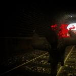 How to register yourself an admin panel on the cs1 server
 Church of the Sign in Dubrovitsy
 Category of historical and cultural significance
 Housing Code non-residential premises are